Khao Yai National Park Map, Khao Yai National Park Khao Yai National Park covers more than 2,000 square kilometers of forest and grassland in central Thailand. More than 50 km of hiking and biking trails wind through the long-standing nature preserve, and The park also shelters diverse wildlife such as bears, gibbons, elephants and hornbills. Khao Yai is along the way from Bangkok to Nakhon Ratchasima province (Korat). The nearest town to the north entrance is Pak Chong, which can be reached either via train or buses running between Bangkok and Nakhon Ratchasima province. From here taxis, local transport or songthaews car, motorbike van rental car hire can take you onto the Khao Yai National Park. The south entrance is about 13 km north of Prachinburi province – Head north on the roundabout on Rt 3077. A road runs through the length of the park from the Pak Chong side to the Prachinburi province side. Way to the park is an easy and convenience drive by road from Bangkok.
Khao Yai National Park Map
[su_gmap width=”1600″ height=”600″ address=”Khao Yai National Park Northern Fee Entrance Station”]
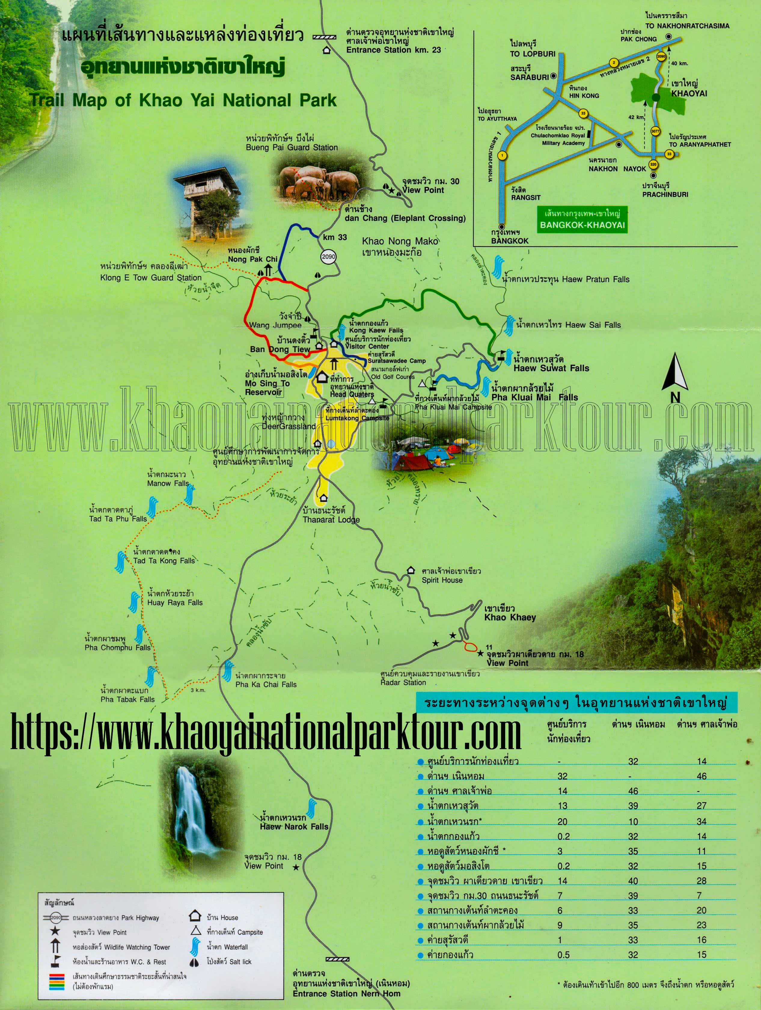
Khao Yai National Park Map Download
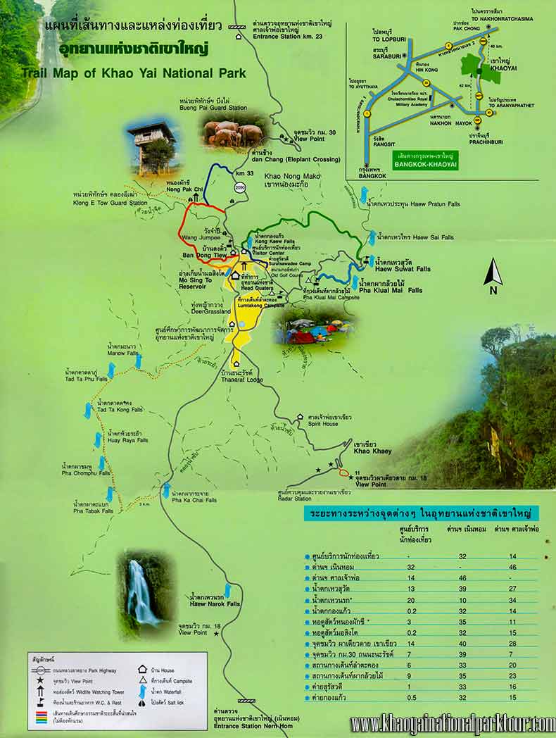
- Click to Khao Yai National Map Download (Large Khaoyai Map for Free Download)
How to get to Khao yai national park from Bangkok?
Bangkok to Khao Yai National Park by CAR
- PUBLIC BUS : From Bangkok’s Mo Chit bus station to Pak Chong
- VAN : From Bangkok’s Mo Chit bus station to Pak Chong
Check for update time & schedule and more information on at www.traco.motc.go.th
Bangkok to Khao Yai National Park by TRAIN
- TRAIN : from Bangkok, depart from Bangkok train station ( Hua Lamphong Station ) recommend you leave from Bangkok early morning about 05:45 AM. The train will arrival time in Pak Chong station is 09:00 AM. ( Approximate time ) Check schedule of the railway station on http://www.railway.co.th
All route after you arrived Pak Chong, then continues with departure from Pak Chong to Khao Yai National Park by local car transport service there, Thai people call Rod Song-Taew Pai Khao Yai ( รถสองแถว ไป เขาใหญ่ ) This local transport service is operates from 8 am. until 5:00 pm.
Bangkok to Khao Yai National Park by PRIVATE CAR
- BANGKOK – KHAO YAI Route 1 : Take Highway No. 1 (Phahonyothin) then Highway No. 2 (Mittraphap) at Saraburi to Pakchaong Nakhon Ratchasima. The total distance is 259 kilometres.
- BANGKOK – KHAO YAI Route 2 : From Bangkok, take Highway No. 304 past Min Buri, Chachoengsao, Phanom Sarakham, Kabin Buri, Wang Nam Khiao, Pak Thong Chai, to Nakhon Ratchasima. The total distance is 273 kilometres.
- BANGKOK – KHAO YAI Route 3 : Take the Bangkok-Rangsit-Nakhon Nayok route then connect to Highway No. 33 to Kabin Buri, then go on to Highway No. 304 past Wang Nam Khiao, Pak Thong Chai


[su_divider]